Able Technology acquires ProjectX On-line Mapping and Addressing Capabilities

July 12th, 2010

Wellington, New Zealand, 12 July 2010

accutane alternatives

Able Technology has acquired the on-line mapping and addressing business of ProjectX Technology Ltd.

The acquisition promises an exciting future for ProjectX developments such as the Address Finder service and mapping applications.

Able Technology director Marcus Baguley says ProjectX’s expertise in geospatial data and mapping services will enable Able Tech to quickly deliver location-based applications; from hand held apps to large corporate websites that want to geo-enable existing datasets.

“The acquisition strengthens our specialised online mapping and data visualisation capabilities,” says Marcus.

The move is a natural progression for Able Tech, an influential member of Wellington’s growing Ruby on Rails software development community.

John Clegg, founder and CEO of ProjectX, says he is very pleased to be handing over to Able Technology “because their experience and reputation guarantee our customers will receive exceptional leadership, services and support.”

The ‘new’ Able Technology will be headed by Carl Penwarden who has joined the company from his previous role as Marketing and Product Development Manager at CityLink.

Carl says, “We are very excited about the capabilities we have brought together – the combination of ProjectX’s broad geospatial and addressing experience along with Able Technology’s strengths in agile development offers a compelling proposition for organisations seeking innovative web applications.”

Members of ProjectX’s team joined Able Technology in early July and will continue to support their existing clients. All staff are located together at Able Technology’s Wellington-based office.

About Able Technology

Able Technology specialises in cloud-based software development and consulting. In addition to their loyal customer base, Able Technology is also the developer of SAAS share portfolio management service, ShareSight.

About ProjectX

ProjectX, an award winning software services company, specialised in online maps development and data visualisation. Recognised by the Open Source Society for its use and contribution to Open Source in business, ProjectX has lead modern technologies such as HTML5.

For More Information:
Contact: Carl Penwarden, 021 222 6848

Awesome geo-visualisations from New York Times

January 14th, 2010

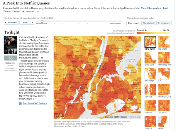
Geo-visualisation and visualisation is becoming more main-stream with media publications creating more and more great visualisations. The New York times have been releasing a constant stream of great geo visualisations, they even have their own visualisation lab on the NYT site. (I’ve also notice that the Guardian has their own http://www.guardian.co.uk/news/datablog also.) Last week the NY Times released an interactive mashup featuring the popularity of Netflix rental across several cities in US.

Using the mashup, you change look change the titles and see the rental popularity of the movie across different zipcodes. Its a great mashup to bring interactivity to data.

I discovered that buy levitra online one of the authors Matthew Bloch has a blog page with all list of the visualisation he’s created for NY Times. Wow, what a great selection of visualisations!

Here’s a sample of my favourite visualisations.


2008 Election results – Obama vs McCain


US Movie Revenue popularity


US Inflation breakdown

Hopefully, as data is becoming more open, we’ll see more Geo-visualisations in New Zealand.

New Year wishes for the mobile web

January 10th, 2010

I spent a bit of time over the Xmas break using the iPhone for reading webpages. I’m hooked on using Google FastFlip as a way to flick through the top blogs and news sites like Techcrunch, ReadWriteWeb, VentureBeat and BBC News. Unfortunately, I discovered how really sucky browsing webpages from a mobile device is. I’m not sure what the percentage of mobile browsers on visiting site is like for the blog / news site, but I’m sure that its growing audience and the experience is far from ideal at the moment.

I’ve come up with a list of wishes that I would like for see get nailed over this year. (These suggestions are not just for iPhone but for all mobile web devices)

1) Automagic website layout engine for mobile web

A couple weeks ago, I discovered Readability, the page re-formating tool that can dynamically format webpages via a javascript bookmarklet (thanks to Lance Wiggs for the link). It was a revelation. Readability removes the clutter and distractions from the a page to just give you a page designed for reading.

Readability is designed for a normal browser not the iPhone. I did a bit of digging and found that someone has found out how to get it working on iPhone – How to get Readability on iPhone

It requires a little bit of yak shaving to get it working. (I promise only a bit of cut and pasting) So far it’s working on 99% of the pages I’ve looked at it and its a lot nicer to us.

The only downside is that I have to load the original page before switching to the Readability template.

Here’s how it looks on iPhone


Original Page
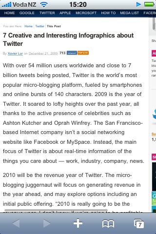
Original Page with zooming


Page with Readability applied

Readability works so well on iPhone that it got me thinking…. Surely there is a way to create a javascript library that would be able to re-format a webpage to work on a mobile device automatically. And it would be able to take into account more simplified navigational and advertising components. So then anyone with a blog can install the javascript and css on their site and be “mobile” ready. This give the content owners control over how their content is going to be viewed. Otherwise, we’ll move the content until we can see what we want.

Wish 1 – A Plugin for styling webpages for Mobile content – I’m sure that there are some clever jQuery hackers that can take the Readability approach and create a javascript library to detect and mobile device and re-factor the layout automagically.

UPDATE: It looks like Instapaper does a lot of what I want – its a mix of Delicious and Readability in that it allows you to download pages on the iPhone to read them offline and it has a mobile template for reading. Looks interesting.

2) Speed and Page Size for website.

Web pages have to be optimised for mobile devices!

I have “grazing” browser behaviour on phone that means I’m sample small bits from a number of pages. S0 I will leave open pages in the browser and re-open them after switching in and around different apps. What I have noticed is that majority of webpages have to completely reload AGAIN. The iPhone doesn’t cache any web objects (html, css , js and images ) over 15K ! (It used to cache 25K but testing has shown that its only caching 15K objects. )

Blog / news pages are often from 100 – 500K. On 3G, the page loading speed is painful. Webpages need to be optimised for web device. I’m not so worried about wasting bandwidth, more so that if its loads slowly, I’ll switch to something else. The iPhone has allowed me to consume the web in byte sized chunks, I want to quick graze not “queue” up for pages.

Optimisation tools that create packaging of CSS / Javascript and Image Spriting will need to have “mobile” settings to take into account of the mobile cache limitations.

iPhone Browsing tip from iPhone caching article

“Tapping the reload icon in the address bar sends unconditional requests for all components, without the If-Modified-Since header and ignoring the Expires header. So to speed up your browsing, refresh the page by tapping the address bar and then tapping GO, don’t use the refresh icon.

Wish 2Standards for the webpages for the mobile web. Mobile pages needs to smaller, more focused. The overall page size including ads should only be around 80-100K. Individual components should be less than 15K. Optimisation tools should have output modes – normal and mobile.

3) Merge Fast Flip + Google Reader
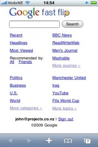


Please Google can you integrate Google Reader and Fast Flip. It would make the killer blog reader on iPhone. I use Fast flip all the time. The sheer volume of some of the blogs like techcrunch is far too much for me to handle and as such I normally ignore it. Using fastflip has allowed me to quickly skim over the articles and drill in and read the ones I’m interested in. I’ve found it a great tool for my blog reading, but I have some requests….

  • Wish 3.1 Use the FastFlip engine on all my feeds from Google Reader.
  • Wish 3.2 Give me the option to only see that pages that I haven’t seen before (not necessarily the one’s that I haven’t read)

UPDATE: Fast Flip is now been integrated into Google News via Fast Company (12/2/10)

The mobile web is getting pretty exciting especially with tools like jQTouch making it easy to make customised UI for mobile sites. We’re going to spend more time on our mobile device, website owners need to optimise our experience to be a joy not a pain in the ass.
Mapsicle updated

December 21st, 2009

We’ve released our first update to the Mapsicle API, version 1.1. Highlights:

  • You can now host Mapsicle locally without modifications.
  • Mapsicle will resize automatically when put in a variable-sized container. (see at StreetTag)
  • You can start Mapsicle without giving a LatLng, and set the position later, like the standard Street View API. (example)
  • You can choose which part of your overlay is positioned on top of the target, like iconAnchor in Google Maps. (example)

There are more details in the CHANGELOG, and you can check out the examples or reference.

Thinking about Mapsicle

November 22nd, 2009

Just seen this blog post about Augmented Reality – a new interface to search, explore and discover.

The blog post has capture the essence of the potential in Mapsicle.

http://www.rocketcontest.org/faqs.cfm

State of the art augmented reality apps enable you to check out what’s around your current position and put it in context of what you can see in a certain direction – soon we’ll find out what’s around the corner in the same photorealistic way – but without having to walk there if it is not worth it.

Thinking about Mapsicle…

We can virtually explore and use augmented virtual reality as an intuitive real world metaphor for search, exploration and discovery.

Mapsicle can be used to make a number of interactive applications to virtually explore locations. What about an streetview driven kiosk to explore a theme park like Legoland or Disneyland.

We’re entering a new age of mashups powered by streetview based applications.

Hire us to build your Streetview Applications

November 18th, 2009

Mapsicle - All Locations_1258497567039
disneyland


Want to view your GIS / data layers on Streetview? Talk to us at ProjectX.

Using the library Mapsicle you can create a whole new world of applications using Google maps streetview.

  • Advanced Store locators: Create store locators that show exactly how to get to your store from the user’s current location.
  • Interactive tours: Combine Street View with content to give tours of the streets of the world.
  • Digital signage: Create interactive advertising on Street View using video and images.
  • Interactive kiosk: Build a touch screen information kiosk for visitors.
  • Games: Build a treasure hunt application or a racing game to drive around Thunderhill raceway

We know how to connect your GIS with Streetview. Whether you have store locations, assets or want to put your companies branding on Streetview, we can help!

We’re looking for clients, who want to make some innovative mashups or want to view their assets using Streetview.

Contact John, if you’re interested in connecting streetview with your data!

Beyond Mapsicle 1.0 – we need your help

November 18th, 2009

Mapsicle 1.0 is live and we’re already thinking about how to make it even better. Its opensource, so we are looking to what features developers want as they look to use it to build applications.

Here is a list of enhancements we’ve been thinking about:

  • Reverse Geocoder for Mapsicle – We want to be able to “click anywhere” on Streetview and return the relative position in 2d space where that point is a lat long. This functionality would help developers to enable users to click on streetview as an easy way to add content.
    This presents a number of challenges as its difficult to be able to translate the depth of the field of view relative to the current position. Is where you are clicking in the next block or across a field or far away from your content location?

    Its hard to calculate – You could use a vector/line pointing out from the location intersecting where you clicked on the map and then geocode along that line to find a set of lat / longs to estimate the location you are looking for. Also you could use the a normal map to triangulate position in 2d space. Or could the streetview navigation polygon help to determine the lat long / position on the surface of the building?

  • Polygons and Polylines – We need to add polygons and polylines to Mapsicle. Imagine being able to create a polygon to match the shape of a building or outline a floor of a building. You would need to be able to click on the polygons like selecting a floor on a building.

    If we create polygons and align them to the surface of a building then we can transform images and create virtual billboards.

  • Height – What’s the height of a position relative to the ground. This would allow applications to figure out the height of a point on a building.
  • Advanced Info-windows – Integrate the advanced info windows as seen in the native google maps API into streetview.

We need you help, we’d love your involvement in making Mapsicle and streetview applications even better.

Introducing Mapsicle – a Street View library

November 17th, 2009

Ever since Street View came out in New Zealand, we’ve been itching to play around with StreetView. As part of our Summer of Code project, Stephen built Street View prototype called Mapsicle. Since then Mapsicle became a pet R&D project at ProjectX.

Today, we’d like to announce the V1 release of Mapsicle as part of the Gmaps-util library.

What can you do with Mapsicle?

Using Mapsicle library, you can do a lot of interesting things:

disneyland

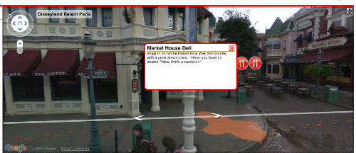
  • Create and show markers at various locations on Street View like at Disneyland Paris

mapsicle_icons

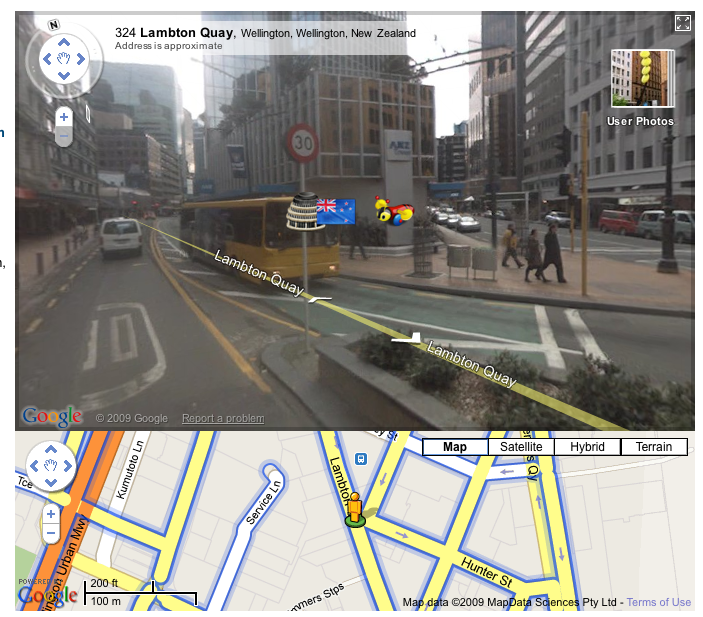
  • Show markers that are outside of the field of view like the NZ flag marker above.

info_window

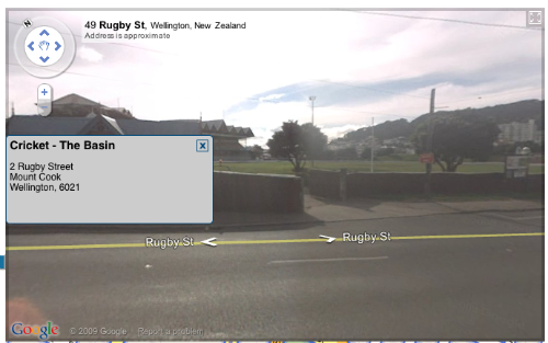
  • Create info-windows at locations.

Getting started

Getting started on Mapiscle is really easy. To add Mapsicle to any page simply:

  1. Download the library from SVN for Gmaps-utils library .
  2. Include the mapsicle.js in the document header
  3. <script src="mapsicle.js" type="text/javascript"></script>
  4. Define a ‘div’ element on your page to contain the Mapsicle object
  5. <div id="mapsicle_div" style="width:600px;height:400px;"></div>
  6. On the page load event, create a new Mapsicle object, with the first param being the id of the container ‘div’ element,
    and the second being the init a GLatLng object for the inital location.
  7. function init(){
        var mapsicle = new Mapsicle("mapsicle_div", new GLatLng(-41.292579, 174.779075));
    }

Simple Example

This example shows the basics of adding a marker and location to the Mapsicle view.

<!DOCTYPE html PUBLIC "-//W3C//DTD XHTML 1.0 Transitional//EN" "http://www.w3.org/TR/xhtml1/DTD/xhtml1-transitional.dtd">
<html xmlns="http://www.w3.org/1999/xhtml" xml:lang="en" lang="en">
    <head>

        <meta http-equiv="content-type" content="text/html;charset=UTF-8" />
        <title>Mapsicle</title>
        <script type="text/javascript" src="http://www.google.com/jsapi?key=YOUR_API_KEY"></script>

        <script type="text/javascript">
            google.load("maps","2");
        </script>
        <script type="text/javascript" src="mapsicle.js"></script>

        <script type="text/javascript">
            function init(){
                var mapsicle = new Mapsicle("mapsicle_div", new GLatLng(-41.292579, 174.779075));
                var marker =  new SVMarker({
                    showOffscreen:true,
                    iconURL:"images/mapsicle_marker.png",
                    width:150,
                    height:150,
                    scale:0.2
                });
                var location = new SVLocation({
                    lat:-41.29249,
                    lng:174.778889,
                    marker:marker
                });
                mapsicle.addLocation(location);
            }
        </script>
    </head>
    <body onload="init();" onunload="GUnload()">

        <div id="mapsicle_div" style="width:850px;height:400px;"></div>
    </body>
</html>

View example (simple_demo.html).

Mapiscle possibilities

We believe there are loads of possibilities in the types of mashups and map applications that you can now create with Mapsicle. Add to that  to the Street View partner program, and Mapsicle will help to launch a new generation of mashups.

Here are some ideas :

  • Annotate locations – Need to annonate a building or a place now you can like or demo – StreetTag.net
  • Advanced Store locators – Create store locators showing you exactly how to get to your store from their current location.
  • Interactive tours – Combine Street View with content to show people interactive tours of the streets of the world.
  • Interative kiosk – What about Street View as a touch screen information kiosk.
  • Digital signage – Create interactive advertising on Street View using video and images.
  • Games – Build a treasure hunt application or what a game to drive around Thunderhill raceway ?
  • Mashups – How about adding Street View to your mashup ?

Contribute

It is early days for the library, and we have a bunch of features that we are working enhance what you can do with Street View. You can contribute and enhance Street View as part of the Google Maps Utility library. We’d really love your feedback to help us improve Mapsicle and build more cool apps for the Google maps platform.

Introducing Cycling and Walking journey planner

September 29th, 2009

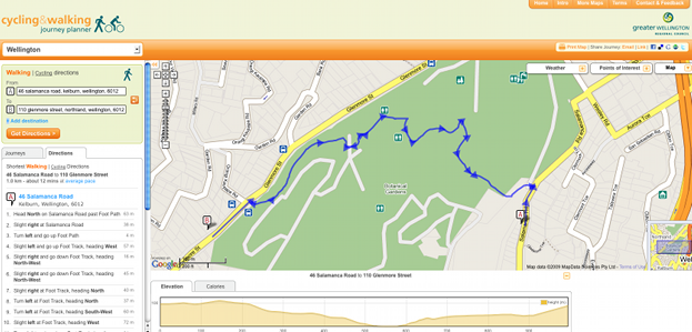
Recently, we released the cycling and walking journeyplanner for our clients the Greater Wellington Regional Council. The journeyplanner website is an advanced map mash-up show advanced directions from different parts of the  region. What makes this site special is that we have combined a lot more data from the councils to include walkways, cycleways, tracks and extra information from all over the regional.

There are a number of unique features:

Picture 14

Routing through the Botanical Gardens

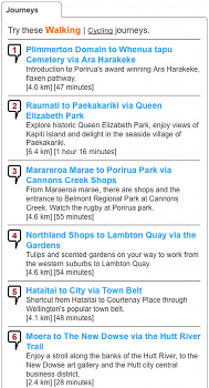
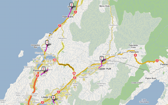
  • Suggested journeys from all over the region to highlight some of more scenic walks around the region.

Picture 21

Picture 22

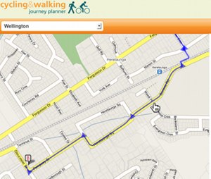
  • Draggable routing over all streets, tracks and walkways around the region. We build our own custom routing engine with draggable routing front-end over google maps.
Routes are fully drag-able

Routes are fully drag-able

Picture 27

Simply select and hold the line, drag to where you would like

Picture 28

Then let go. The route and description will automatically update.


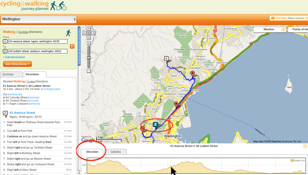
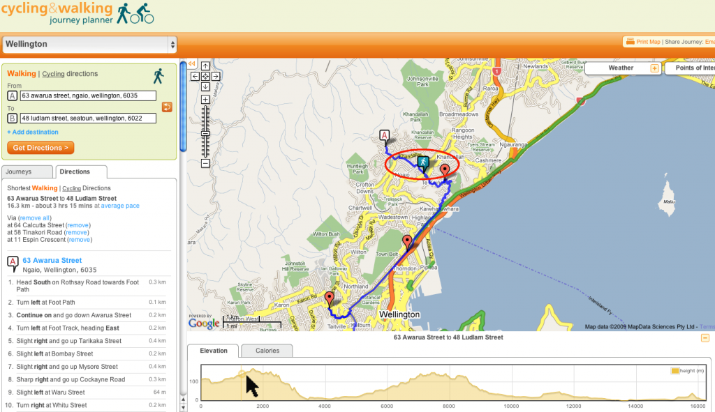
  • Elevation graph with live feedback on the map. See the little icon travel across the map as move across the elevation graph.

Picture 29a

Picture 32a

Picture 15

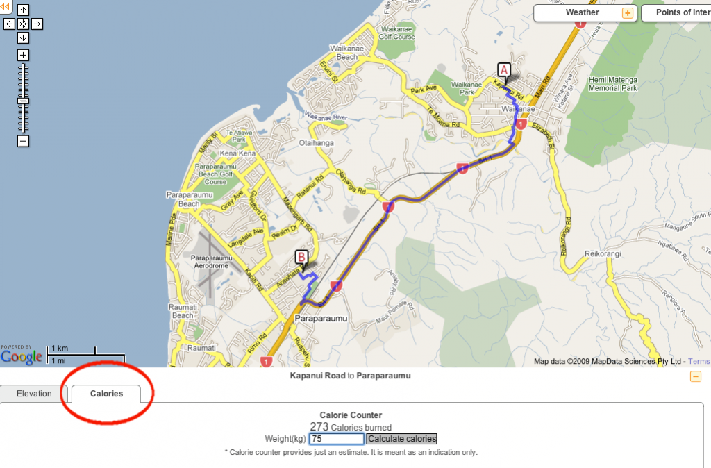
  • Calorie counter to figure out how much energy you could burn.

Picture 17

This has been one of the bigger projects for ProjectX and we’ve got a number of people and partners to thank.

Jill, Simon and Ian from GW. Thanks for your belief in the project and the patience to see it through to end, from wireframes to through all eight iterations until the final release. Thanks to Michael for being our physical location guru who helped connect the physical world to the data files.

Big thanks to the ProjectX team for the work on their hard work on project – Thong, Tim, Gaetan, Stephen, Cameron, Boris, Felix, Raja and Nahum. Dr Geof Leyland from Incremental for the providing our routing algorithm and advice on making it super-fast.

Our design team via Lushai user experience team- Lulu for her interaction design, and wireframes Amiria for the lead graphics, Brent and Chika for supplementary graphics.

Deployment Script Spring Cleaning – GitHub

August 11th, 2009

If you are a Git user and deploying using Capistrano, you might be interested in this article from GitHub:

Deployment Script Spring Cleaning

Read the rest of this entry »


http://www.canakkaleruhu.org http://www.vergimevzuati.org http://www.finansaldenetci.com http://www.securityweb.org http://www.siyamiozkan.org http://www.fatmaozkan.com http://www.sgk.biz.tr http://www.denetci.gen.tr http://www.bagimsizdenetim.biz.tr http://www.mevzuat.biz.tr http://www.security.biz.tr http://www.sorgulatr.com http://www.kanunlar.biz http://www.prsorgu.net http://www.sirabul.com http://www.emekliol.org http://www.coklupagerank.com http://www.coklupagerank.net http://www.coklupagerank.org http://www.prsorgu.org http://www.scriptencode.com http://www.sirabul.net http://www.sirabul.org http://www.sitenizanaliz.com http://www.seoisko.com http://www.seomavi.com http://www.scriptencode.net http://www.scriptencode.org